


Oberdorf - rocher de Granges

rebetez
User

Length
18.5 km

Max alt
1404 m

Uphill gradient
474 m
Km-Effort
27 km

Min alt
665 m

Downhill gradient
1084 m
Boucle
No
Creation date :
2014-12-11 00:00:00.0
Updated on :
2014-12-11 00:00:00.0
--
Difficulty : Unknown

FREE GPS app for hiking
 SityTrail
IGN / Geographical institutes
SityTrail Plus
The world is yours!
About
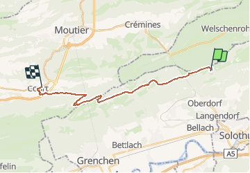
Trail Other activity of 18.5 km to be discovered at Solothurn, Bezirk Lebern, Oberdorf (SO). This trail is proposed by rebetez.
Description
Départ Crémines
Positioning
Country:
Switzerland
Region :
Solothurn
Department/Province :
Bezirk Lebern
Municipality :
Oberdorf (SO)
Location:
Unknown
Start:(Dec)
Start:(UTM)
387134 ; 5234230 (32T) N.
Comments